
A strong spring storm system is currently passing through Ohio, leaving behind heavy rainfall, high winds, and a risk of localised flooding in communities across the state. The National Weather Service has issued a number of flood watches and severe thunderstorm warnings for several counties in the Midwest as the system moves to its eastern side.
Rainfall may reach up to one inch per hour in the central and northern parts of Ohio, and in other places may reach a depth of two or three inches before nightfall. The strongest cells may have gusty winds up to 50 miles per hour that may blow tree limbs and power lines, and may have small hail.
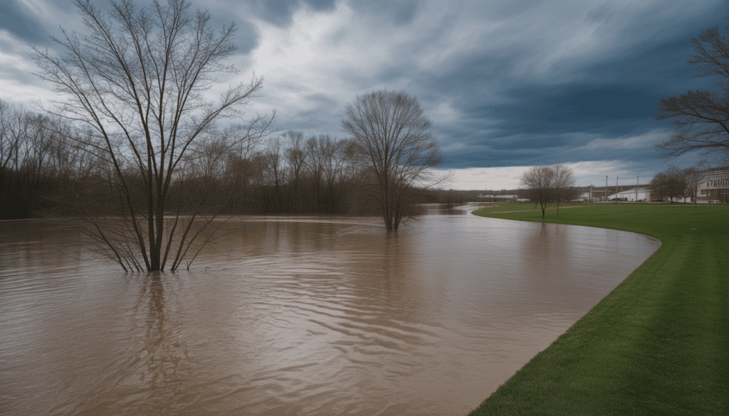
Areas With Richest Potential
The most active time will be the afternoon and early evening in Central Ohio, including the Columbus metropolitan area. Counties in the North that are close to Lake Erie and the Toledo area might also experience short periods of heavy downpour that would flood the storm drains and may result in street flooding. In Southern Ohio, it will be light yet substantial rain, and the probability of destructive winds.
The travellers are encouraged to reduce their speed and allow more time for their commutes, particularly on interstates and in rural areas, where visibility is lost quickly. Hydroplaning and standing water are also significant problems for drivers during the day.
Subsidiary utility crews are already on standby throughout the state and can be used to address any power outages that may occur due to the storm. The authorities advise the population to charge batteries, pack flashlights, and avoid using candles in case of a power outage.
This storm formed as a result of a clash between warm air from a front and cold air, creating an unstable atmosphere necessary to produce strong thunderstorms. Although the likelihood of tornadoes is low, isolated severe cells might cause brief rotation, and residents must have a safe place inside their homes in case of warnings.
It is expected that the main line of storms will clear eastern Ohio by the end of the night, but the showers may extend till the morning of Wednesday. The unpredictable weather event in early April in the state is an eye-opener about how spring can be unpredictable, and a timely reminder for families to check their emergency plans.
The local emergency management offices are also continuously monitoring river levels and low-lying areas. The householders in the flood-prone areas must take their valuables to a safe place and refrain from walking or driving through the flowing water.
As the period of severe weather in 2026 is only starting, storms today provide a valuable exercise of the community’s preparedness. Residents of Ohio are asked to keep up with local news channels and weather apps when visiting elderly neighbours and those who live alone.
Families around the state can ride the system safely by following current warnings and taking simple precautions to stay safe and enjoy better weather in the next few days.